Explore the beauty of asia

#

feel your adrenaline increase when skydiving at whitesunday

Rio de Janeiro

Explore the amazing City

Enjoy the beauty of Bondi Beach

don't miss to enjoy the romantic atmosphere of bondi beach at the night.

This is default featured slide 5 title

Go to Blogger edit html and find these sentences.Now replace these sentences with your own descriptions.This theme is Bloggerized by Lasantha Bandara - Premiumbloggertemplates.com.

Showing posts with label Australia. Show all posts

Wednesday, 24 February 2016

Sua Ocean Trench of Samoa


Samoa volcanic island offering the natural swimming pool as a travel destination which gives incredible experiences. You can enjoy the scenery of crystal clear waters with tropical fishes and pebbles. this place called 'Sua Ocean Trench' which is mean big hole. it is located on lotofaga village, south of Upolu island, Samoa. Sua Ocean Trench formed by volcanic eruption which caused the collapse land surface and formed a big hole with 98 feet depth.

tourists who came to this places not only can witness the scenery, but they also can feel the sensation of fresh waters in this natural pool directly. to reach the bottom of pool, the tourists should descend the stairs. you should be careful while descending the stairs, especially when you use the slippers. because it is very slippery.

in addition, there is a board that can use by the tourist for jumping into the pool. this facility is very appropriate for people who want to feel the sensation of adrenaline. but if you don't want to jump into the pool directly, you can descend the stairs for your safety. the natural beauty's made sua ocean trench assigned as the big five places with the most beautiful nature in the world based on netizen review on the internet.

reported from dailymail, for keeping the serenity of this tourism place and to keep the safety of tourist when they toward to this place and when they swimming in this pool the tourists will charge around $15 for adult and $5 for children.


Friday, 17 July 2015

Hobbiton, New Zealand

Hobbiton is a fictional village which appeared in the novels: “The Lord of the Rings” and “The Hobbit” by by J.R.R. Tolkien. Hobbiton village was built as a set (for the films which were based on the Novels) is located on a farm near a little town called Matamata in northern New Zealand. It was decided to keep the Hobbit holes set  as tourist attractions, (they blend smoothly into the environment), there is even a sign which says :”Welcome to Hobbiton” on the main road, directing people to this wounderful little Hobbit town.
Green Dragon

Although the set was not built to last, the hobbit hole facades having been constructed from untreated timber, ply and polystyrene, it was evident that the location was of interest to tourists. Guided tours of the 5.5 hectares (14 acres) movie set site commenced in 2002 and continue to be provided on a daily basis, the two hour excursion having to be booked in advance. Highlights of the tour include Bagshot Row, the Party Tree, and Bilbo's Bag End home. There are now 44 hobbit holes on view although it is not possible to enter any of them. (The interior of Bag End was shot in a studio in Wellington.

Two hours south of Auckland lies the lush farmland of the Hamilton - Waikato region. Famous for dairying and fine thoroughbred horses, it's easy to see why these green pastures and rolling hills were chosen to portray Hobbiton and The Shire.

Hobbit fans can visit the Hobbiton Movie Set on a guided tour; it has more than 44 unique hobbit holes, including Bag End (Bilbo's house). As you wander through the heart of the Shire, you'll get to hear the fascinating commentary about how it was all created. Along your journey you'll see the mill, the double arched bridge and the famous Party Tree before stopping for a drink at the Green Dragon Inn. Evening tours are also available, and they include a feast fit for a hobbit!

A number of great farmstays are also on offer in Matamata. Just east of town you can discover the North Island’s highest waterfalls, Wairere Falls, which are a spectacular sight plunging 153m.
The Wairere Falls walking track showcases a diverse range of natural scenery and from the lookout you can enjoy magnificent views over the valley and the Waikato Plains. Matamata is situated 2 hours' drive from Auckland, 45 minutes from Hamilton and 1 hour from Rotorua.

Tuesday, 14 July 2015

Liffey Falls

Prepare for total tranquillity at Liffey Falls, which sit nestled in Tasmania's Great Western Tiers about an hour's drive from Launceston and 90 minutes from Devonport. There are few settings more peaceful than here, in this World Heritage-listed rainforest, where you listen to bird song and watch water cascade over sandstone. Follow the enchanting nature trail to Liffey Falls or spend a relaxing afternoon in the fern-fringed picnic area. Just nearby, you can explore the quaint craft-loving village of Deloraine and the limestone caves of Mole Creek Karst National Park.
Part of Tasmania's World Heritage area, Liffey Falls State Reserve is easily accessible from Launceston and Devonport, and around two and a half hour's drive from Hobart. Both Tasmanians and tourists travel here to picnic and wander through wet eucalypt forest to the base of Liffey Falls. It's the last and most spectacular of four falls which tumble down from the Great Western Tiers, exposing sandstone steps on their rush into the Liffey River.  The 40-minute return walk to Liffey Falls is well-paved and has plenty of viewing platforms where you can photograph the upper cascades.

The Gulf Road Walk is a longer, quieter track leading past the falls to the Gulf Road Picnic Area, which was once a logging camp. It takes around two to three hours return to complete, and offers excellent views of Drys Bluff, the highest peak in the Great Western Tiers. Alternatively, the Liffey River Track is a 90-minute walk that starts in the Great Western Tiers, off the Lake Highway, and winds downstream to the Liffey Picnic Area.
The less energetic can just enjoy lunch in the dappled sunlight of the Liffey Picnic Area, which sits near the park's entrance and car park. It has picnic shelters and gas barbecues and is fringed by tall manferns and eucalypt trees like myrtle, sassafrass and leatherwood. There's also the Big Tree Stroll, a boardwalk looping around the base of an enormous eucalypt. The reserve shelters an array of wildlife, from birds to bats to bandicoots. Look and listen out for pink robins, green rosellas and fairy-wrens in the rainforest and spot giant crayfish and the shy platypus in and around the clear waters of the Liffey River. You might spot Tasmanian devils, quolls, bandicoots and wallabies foraging for food at dusk.

On your journey back from Liffey Falls, make time for a stopover in the charming, heritage-listed riverside village of Deloraine. In November, the town's beautifully-restored Georgian and Victorian architecture is the backdrop for one of the country's biggest craft fairs. Hunt for antiques, meet Tasmanian devils in the wildlife park and meander between farms and factories selling honey, cheese, berries and salmon. Another nearby attraction is Mole Creek Karst National Park, where you can tour the spectacular limestone caves, discovering glow worm displays and subterranean streams and caverns. There is so much to discover in and around Liffey Falls and its tranquil tract of nature.

Wineglass Bay Tasmania

wineglass-bay
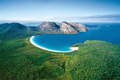
Wineglass Bay, on Tasmania's Freycinet Peninsula, is considered one of the top ten beaches in the world. This flawless crescent of dazzling white sand and sapphire-coloured sea set against pink and grey granite peaks is one of Australia's most beautiful natural environments. It's the perfect location for fishing, sailing, bushwalking, sea kayaking, rock-climbing, or simply soaking up the spectacular coastal scenery. Wineglass Bay has become a favourite honeymoon destination for couples to escape and relax away from the rest of the world. With secluded sandy beaches, luxurious eco-lodges, and fine Tasmanian cuisine, Freycinet Peninsula is an adventure of pure indulgence.

Wineglass Bay is part of the Freycinet Peninsula, an outcrop of wild, pristine coastland on Tasmania's east coast. The entire peninsula, comprising Friendly Beaches, Wineglass Bay and Schouten Island, is encompassed within the Freycinet National Park.An almost perfect curve of pure white sand fringed by turquoise waters has earned Wineglass Bay a reputation as one of the top ten beaches in the world.
Equally beautiful are the wide deserted beaches and aquamarine shallows at Bryans and Cooks beaches on the western side of the peninsula facing Great Oyster Bay. On the eastern side of the Freycinet Peninsula there are soaring sea cliffs, secluded coves, and dramatic ocean beaches. The remarkable pink granite peaks known as The Hazards guard the peninsula at its northern end, and to the south is uninhabited Schouten Island.

Wineglass Bay is just a short walk from the camping grounds at Coles Bay. The walk to Wineglass Bay involves an uphill climb through The Hazards to a rocky lookout, followed by a downhill walk to the beach. It takes around two hours to walk to Wineglass Bay from the entrance of the Freycinet National Park.

The award winning Freycinet Experience Walk is a four-day guided walk covering the entire length of the peninsula including Wineglass Bay. The peninsula was home to the Oyster Bay Tribe of Tasmanian Aborigines for at least 20,000 years. Some of the tracks are paths walked by the area's original Aboriginal inhabitants thousands of years ago. Learn about the French explorers who first discovered this paradise. Watch for wildlifeincluding white-bellied sea-eagles, quolls, wallabies, wombats and Tasmanian devils. Set off on a scenic cruise where you might be lucky enough to see a pod of dolphins or migrating whales in season. Take a 4WD to the cobblestone shore of Bluestone Bay or Cape Tourville Lighthouse for unforgettable views.

The area is also renowned for its deep sea fishing, rock climbing, scuba diving and mountain biking. A scenic flight reveals the whole breathtaking panorama from above. Taste crayfish, scallops and fresh oysters picked straight from some of the world's cleanest waters, complemented by Tasmania's internationally acclaimed cool-climate wines. 
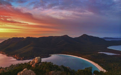
wineglass-bay-sunset
Relax in your luxury lodge watching the sun set across the water and you will feel truly in touch with the beauty and depth of nature. Wineglass Bay is approximately two and a half hours drive north of Hobart or south of Launceston.

Thursday, 9 July 2015

Cable Beach Broome

Cable Beach broome
Cable Beach, at Broome in Western Australia's Kimberley region, is a 22 kilometre-long stretch of pure white sand, set against a backdrop of red ochre cliffs and fringed by the turquoise waters of the Indian Ocean. Ride a camel along the beach at sunrise or sunset. Just a short trip from Broome, immerse yourself in the town's romantic pearling history and multicultural society.
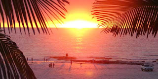
Nice sunset at cable beach
Shop for precious South Sea pearls. Marvel at the natural phenomenon of the Staircase to the Moon. Learn about one of the oldest cultures on Earth from the local Aboriginal community. From pearl diving to dinosaur footprints, Broome's history is captivating. Broome's Cable Beach is known around the world for its 22 kilometres of sun-kissed white sand, turquoise water, rich red soil and spectacular Indian Ocean sunsets. Cable Beach is a long, flat beach, with gentle rolling waves perfect for swimming, sunbathing and beachcombing.
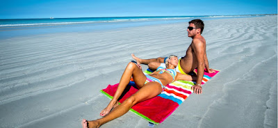
The beach is very much a part of Broome's history, earning its name from the telegraph cable laid between Broome and Java in 1889, connecting Australia's North West with the world. At the southern end of Cable Beach is Gantheaume Point where at low tide, you can see 130-million-year-old dinosaur footprints. Gantheaume Point Lighthouse is a wonderful place to watch for dolphins and migrating whales in season. Sunset over Cable Beach is simply spectacular. One of the most popular activities is riding a camel along the beach. Drive your 4WD on to the sand for a picnic dinner and a spot of fishing. Sip a cocktail at a beachside bar in one of the string of resorts beside the beach.
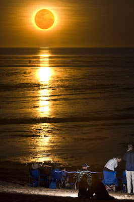
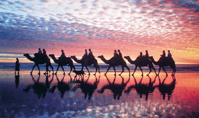
Cable beach sunset

Minyirr Park is a coastal reserve directly behind the sandhills along Cable Beach which is run by the Shire of Broome and the Rubibi Aboriginal people. Learn about the oldest culture in the world, Australia's native plants and animals, and the bush medicines that are still used today.
relax at cable beach

Broome lies on sheltered Roebuck Bay, with Cable Beach just six kilometres away. Between March and October you can see the Staircase to the Moon, a natural phenomenon caused by the full moon rising over Roebuck Bay at low tides, creating a beautiful optical illusion of a staircase reaching to the moon.
staircase to the moon

In the 1800s Japanese, Filipino and Malay pearl divers arrived seeking their fortune. Today, the town's multicultural society ensures a wonderful array of gourmet cuisines, colourful characters and culture. Broome is known as the pearling capital of Australia and the home of South Sea pearls.
cable beach
See how Broome pearls are cultured on a cruise to a local pearl farm. Immerse yourself in the romantic tales of the original pearl luggers, or pick up a memento of your trip in the pearl showrooms of Broome's Chinatown. Wander into the neighbouring galleries and admire the works of the Kimberley's contemporary and Aboriginal artists. As spectacular as Cable Beach is, Broome is also the gateway to outback adventures in the stunning Kimberley wilderness so make sure you have time to enjoy the contrasts of this unique location.


Katherine Gorge Australia

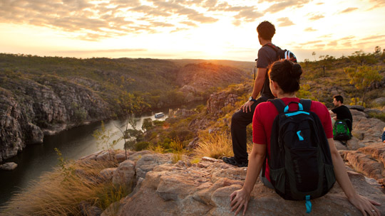
sunset at katherine gorge australia
The Northern Territory's Katherine region stretches from Dunmarra in the south to the Daly River region in the north. In total it covers an incredible 480,000 sq kilometres. From east to west it touches both the Queensland and West Australian borders. Katherine and its surrounds are the place to go for true outback adventure and indigenous experiences. The town of Katherine is the central hub of the region and offers museums, art galleries and historic sites. It is a good place to buy authentic Aboriginal art and artefacts; or create your own original dot painting to take home.
view-katherine-gorge-australia.jpg

The Katherine Museum has wonderful displays of photos of the history of the region. Just out of town is Springvale Homestead, the oldest original homestead in the Northern Territory. The nearby fascinating Cutta Cutta Caves are a series of sparkling limestone crystal caverns and pillars dating back 500 million years.
Katherine Gorge, Nitmiluk National Park, NT
Katherine gorge

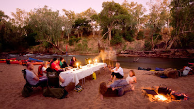
Dine on traditional bush tucker around a campfire under clear star-filled skies. Take a refreshing swim at the Katherine Hot Springs. South of town you'll find the spectacular Mataranka Thermal Pools and Bitter Springs. The jewel in the crown of the Katherine region is Nitmiluk (Katherine Gorge) National Park.
katherine gorge australia
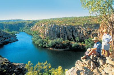
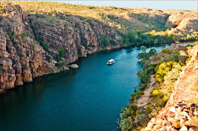
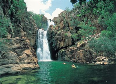
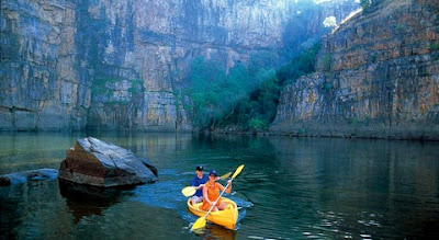
The park sits at the southern tip of Kakadu National Parkand Aboriginal-owned Arnhem Land. Here you'll find a landscape of rugged sandstone cliffs, dramatic waterfalls and lush rainforest. The Edith Falls waterfalls flow all year round and are a great spot for swimming, picnics and camping. Take a cruise along the spectacular Katherine Gorge, a series of sandstone gorges carved over millions of years which stretch along the Katherine River. You can camp by a billabong and fish for barramundi in the clear waterways.
Mataranka, NT
dinner at katherine gorge
The best way to explore the grandeur of the gorge is to tour it with one of the Jawoyn people, who run Nitmiluk National Park in conjunction with the Parks and Wildlife Commission of the Northern Territory. Aboriginal culture is strong in the area and there are many significant rock art sites throughout the park. The more challenging five-day Jatbula Trail is a 59-kilometre trek which follows the song line of the local Jawoyn people. View the whole spectacular panorama from above on a scenic flight.
Barunga Festival, Katherine, NT
Barunga dancer
The Katherine region hosts a number of events during the drier months from May to August. See Aboriginal culture at the Walking with Spirits Festival and Barunga Festival. Mix with the locals at the Katherine Show and Katherine Festival. A number of regional fishing competitions will attract enthusiasts. From Katherine follow the Savannah Way to the Gulf of Carpentaria visiting remote fishing villages such as Borroloola and the Barranyi (North Island) National Park. Katherine is around 300 km south of Darwin and around 1200 kilometres north of Alice Springs.
canoe in katherine gorge
It is a few hours' drive from Katherine to Kakadu, Litchfield and Gregory National Parks. Katherine offers accommodation styles from upmarket apartments and motels to backpacker's lodges and camping sites. The Ghan train journey visits Katherine on its route from Adelaide to Darwin.

Wednesday, 8 July 2015

The Ancient Art of Kakadu

Kakadu national park australia
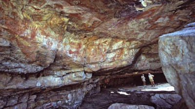
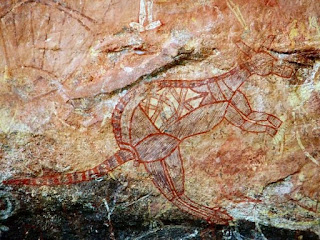
In amongst the wetlands, wildlife and rugged gorges, World Heritage-listed Kakadu National Park holds one of the highest concentrated areas of rock art in the world. As many as 5,000 Aboriginal sites have been found here, including rock art, shelters, stone tools, grindstones and ceremonial ochre. This detailed, dramatic record of life in Kakadu stretches back more than 50,000 years - from the first evidence of human occupation to the arrival of Europeans.
kakadu ancient art rock

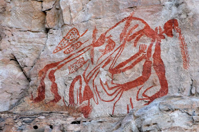
Aboriginal families camped in rock shelters around Ubirr in Kakadu's north-east, and today you can see paintings of the fish and animals they hunted. Barramundi, catfish, mullet, goannas, turtles, possums and wallabies line the back wall in the main gallery in a rich, ochre tapestry of life. You'll also see some of the world's finest examples of X-ray art - where animals' bones and organs are as visible as their exteriors - in this gallery. Other paintings record contact with the first ‘whitefellas' in the area, thought to be the early buffalo hunters of the 1880s. One has his hands in his pockets, while another has his hands on his hips and is ‘bossing Aboriginal people around'.
kakadu ancient art rock

Not far from this gallery you'll find paintings of the Namarrgarn Sisters - cunning spirits who live in the stars and can make people sick with a string. In another site in the area you'll see a painting of the Rainbow Serpent that is more than 23,000 years old. This quietly powerful 'boss lady' is known as Garranga'rrelito to the local Gagudju tribe.
kakadu ancient art rock

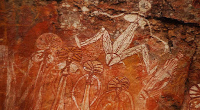
At Nourlangie Rock, an outlying formation of the Arnhem Land Escarpment, you can see the crevices cut by Dreamtime ancestors in the form of short-eared rock wallabies. These crevices are still visible today, and rock wallabies are often seen there in the early morning and dusk. In the nearby Anbangang Gallery you'll see a painting of Lightning Man, the Dreamtime ancestor who still controls the violent lightning storms that happen every wet season. Nearby is Nanguluwu, where acclaimed artist Najombolmi painted a Mimi Dreamtime spirit figure throwing a spear during the 1960s. You'll also see paintings depicting the arrival of Europeans - including one of a two-masted sailing ship with anchor chain and dinghy trailing behind.
kakadu ancient art rock

 
According to Dreamtime myth, Mimi spirits were the first ancestors to paint on rock. They passed their knowledge on to some Aboriginal people, while others learned by copying Mimi art. Sometimes ancestral spirits entered rock walls as paintings, turning them into sacred dreaming places.
kakadu ancient art rock

With the arrival of Europeans and the changing lifestyle of Aboriginal people, the tradition of rock art has been largely succeeded by painting on bark, paper and canvas. Kakadu's most recent rock art was painted in 1986 and the last flurry of activity before that was Najombolmi's work during the 1960s.
Today you can explore this vast cultural treasure trove with a local Aboriginal guide. In amongst Kakadu's lush rainforest lies an epic history of human occupation.

Tuesday, 7 July 2015

Uluru national park

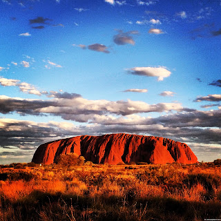
World Heritage-listed Uluru is one of Australia’s most iconic symbols. Located in the heart of Uluru-Kata Tjuta National Park in Australia’s Red Centre, Uluru is an ancient landscape, rich in Australian indigenous culture and spirituality. There are many ways to experience the majesty of Uluru and the beauty of this unique desert landscape. Take a walk with an Aboriginal guide and learn about ancient traditions and stories from the Dreamtime. See it from the skies by helicopter or hot air balloon. Ride across the ochre coloured desert on a Harley Davidson motorcycle or on the back of a camel.

The traditional custodians of Uluru, the Anangu, believe this landscape was created by their ancestors at the beginning of time, and they have been protecting these sacred lands ever since. The Uluru-Kata Tjuta Cultural Centre is a great starting point for visitors. Learn about Tjukurpa, the traditional law guiding the Anangu people. Take a dot painting workshop, where Aboriginal artists will show you how they express their culture through art. You’ll have your own original artwork to take home
as a memento. Take a walk with an Aboriginal guide and learn about their ancient traditions and stories from the Dreamtime.

There are a number of ways to experience the majesty of Uluru. No-one misses sunrise and sunset. At different times of the day the colours change, from pink to purple to dark red, while the sky reflects a superb array of colours. See it from above by helicopter or hot air balloon. Ride across the desert on a Harley Davidson motorcycle or on the back of a camel. Although it is possible to climb Uluru, the traditional owners do not because of its great spiritual significance, and in respect of their culture ask that others do not climb it either.

Experience the Sounds of Silence dinner at Ayers Rock Resort and learn about the tales of the southern night sky with a ‘star talker’. Feast on authentic Australian delicacies such as barramundi, kangaroo and crocodile, complemented by fine Australian wines. Longitude 131 is the closest accommodation to Uluru itself and offers spectacular sunrise and sunset views over the rock from its luxury safari tents set amongst the sand dunes. Or pitch a tent in the Ayers Rock Campground under the shade of native desert trees. You can even stay on an authentic Australian outback cattle ranch at Kings Creek Station.

Uluru is approximately 460 kilometres or a six hour drive southwest of Alice Springs. Many visitors choose to explore Australia’s outback at their own pace by driving the Northern Territory’s famous Red Centre Way. This gives you a chance to explore many of the Northern Territory’s major attractions including Alice Springs, Uluru, Watarrka National Park and Kings Canyon and the West MacDonnell Ranges. Another way to experience Australia’s Red Centre in comfort and luxury is on The Ghan, a legendary rail journey from Adelaide to Darwin which stops at Alice Springs and offers a side journey by coach to Uluru.